This is a book about a forgotten people who lived along the short Wakulla River south of today’s state capital in Tallahassee, Florida. It follows what happened to Creek natives who found themselves torn between allegiances. Was it going to be to a British trading post in Spanish Florida, to Spain, or to the United States of America? Two individuals, Creek leaders William and John Kennard, would be pivotal to life along this river that has its origin in the world’s largest and deepest freshwater spring, the Wakulla Spring.


The scenes:
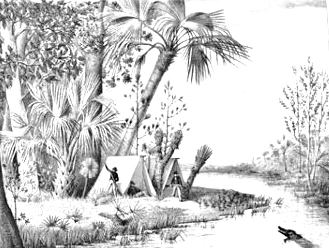
The top image is a sketch taken from Comte Francis de Castlenau‘s travels to the Wakulla River. He most certainly would not have seen many traces of Creek villages (as shown in the second image). The population had largely disappeared from the area between 1811 and 1821 when Florida became a United States Territory. Before then, the heirs to the Forbes company wanted to create Pantonia (R). It was located within the Hartfield Survey (1804, 1811) along the Wakulla River and named for the late trader William Panton. The map is attributed to Vicente Sebastián Pintado, Surveyor General of Spanish West Florida, 1805-17. Click on the blue names to see the French travel notes of Castlenau, or to go to the Pantonia map.
Never easier to follow the local history in Wakulla County than now. Order online as an e-book or hard copy.
