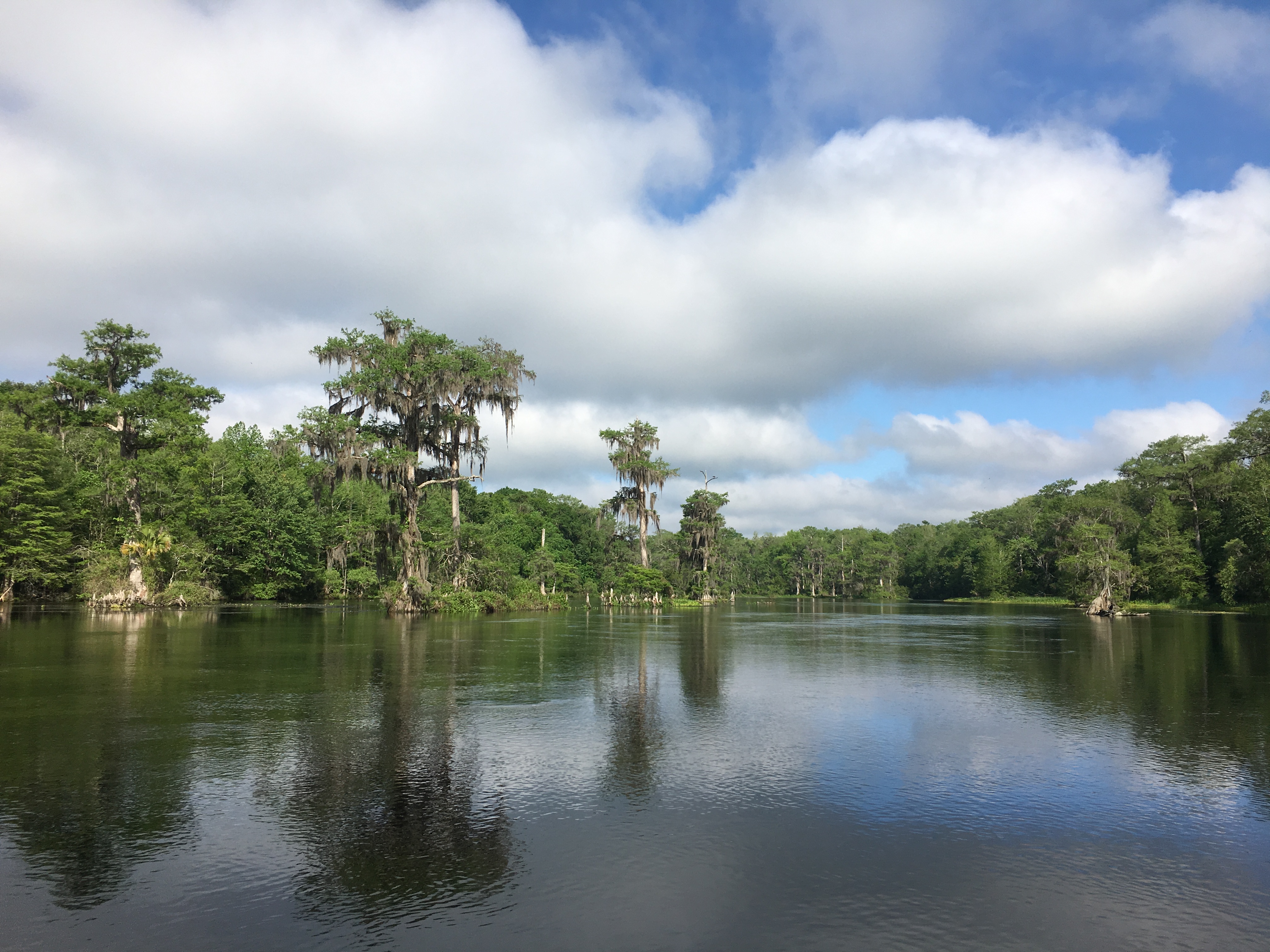
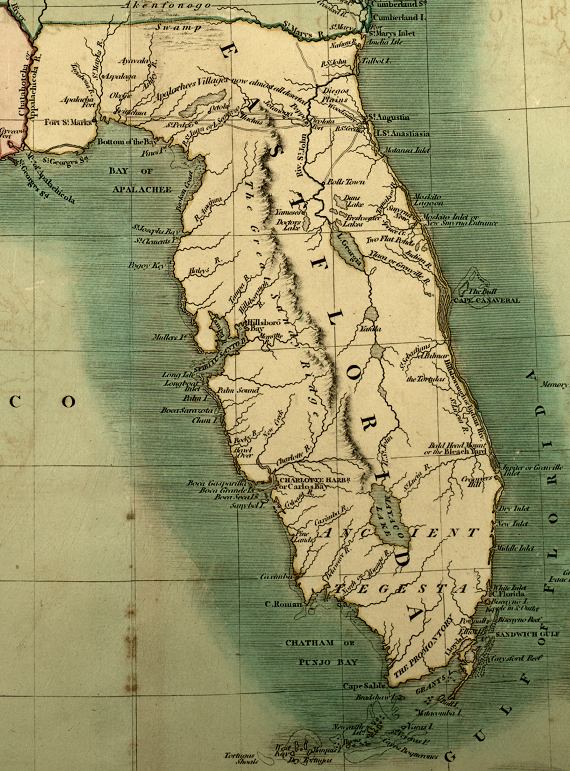
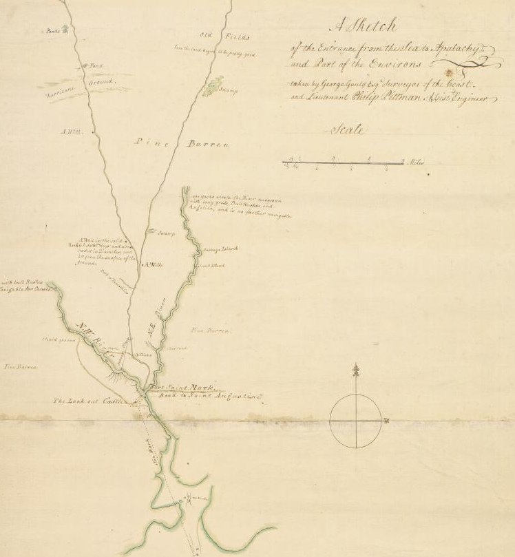
The Wild and Scenic Wakulla River http://www.wakullasprings.org Another map (not in the book) for those who are reading. This was East Florida with a reference to “Apalache Fort”:
Historic Maps Available Online:
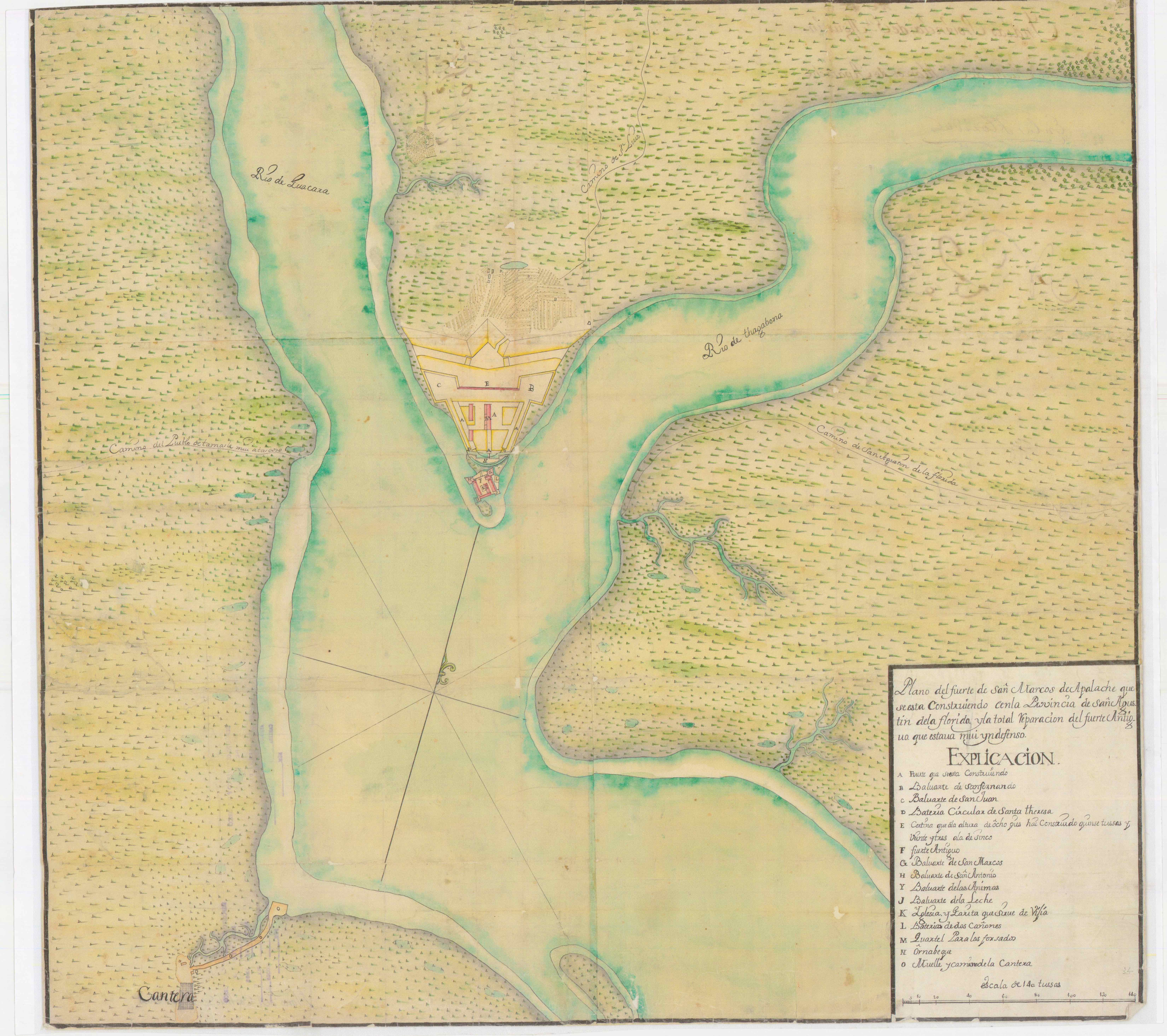
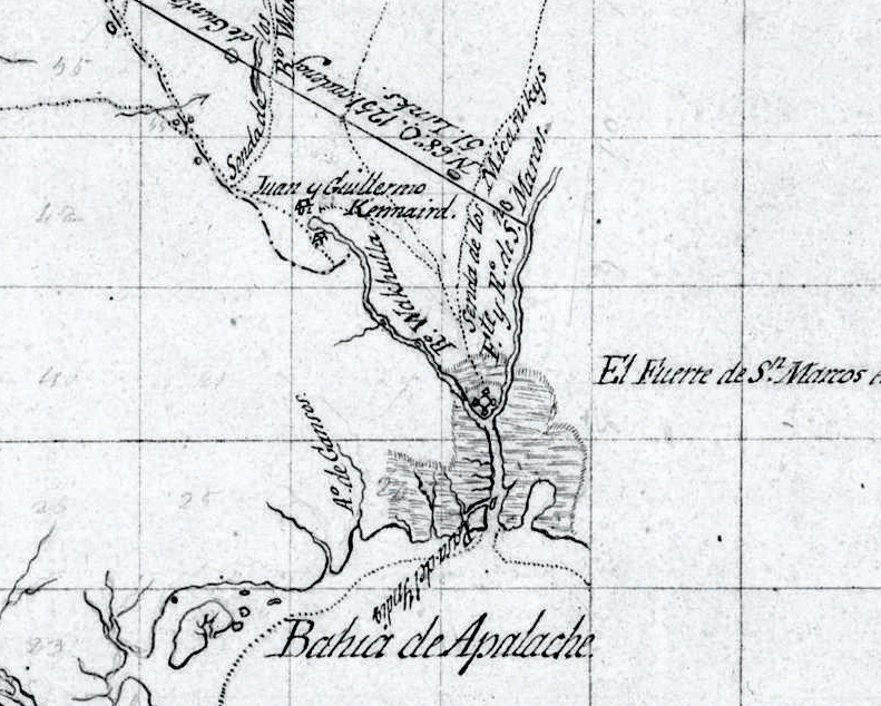
1796 Map of the State of Georgia https://www.libs.uga.edu/darchive/hargrett/maps/1796g4.jpg 1760 Spanish map showing quarry (cantera) southwest of Fuerte San Marcos de Apalache.
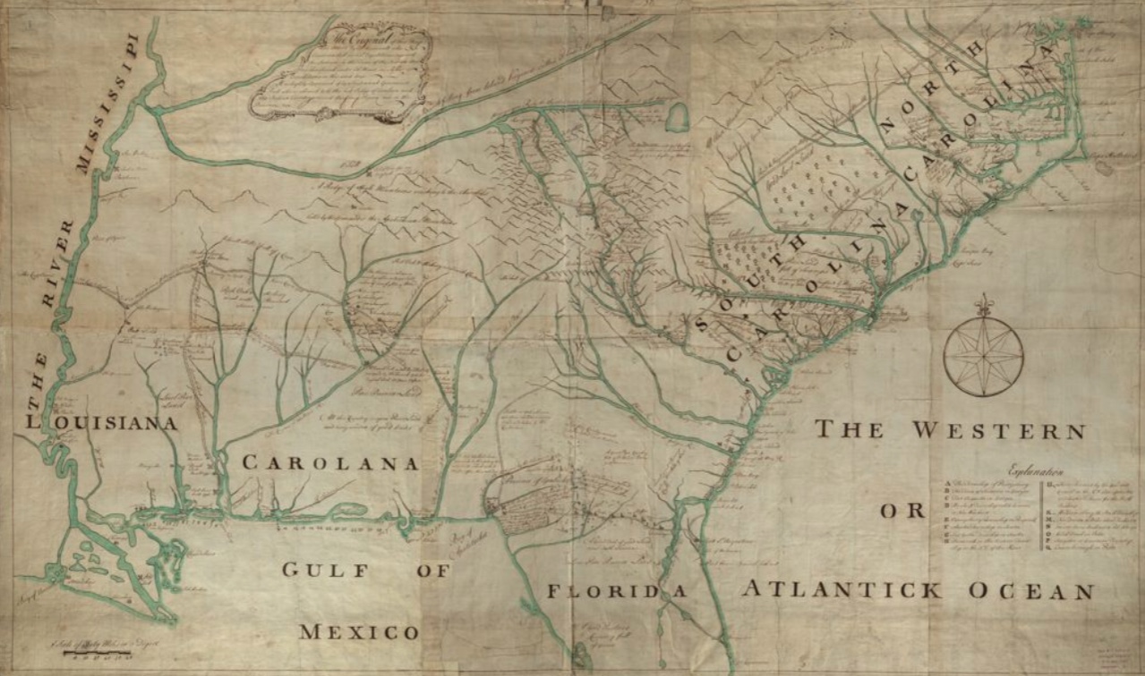
” A sketch of the entrance from the sea to Apalachy and part of the environs.” 1767 outline map of rivers “falling into Apalachee Bay” by George Gauld.http://quod.lib.umich.edu/w/wcl1ic/x-865/wcl000959
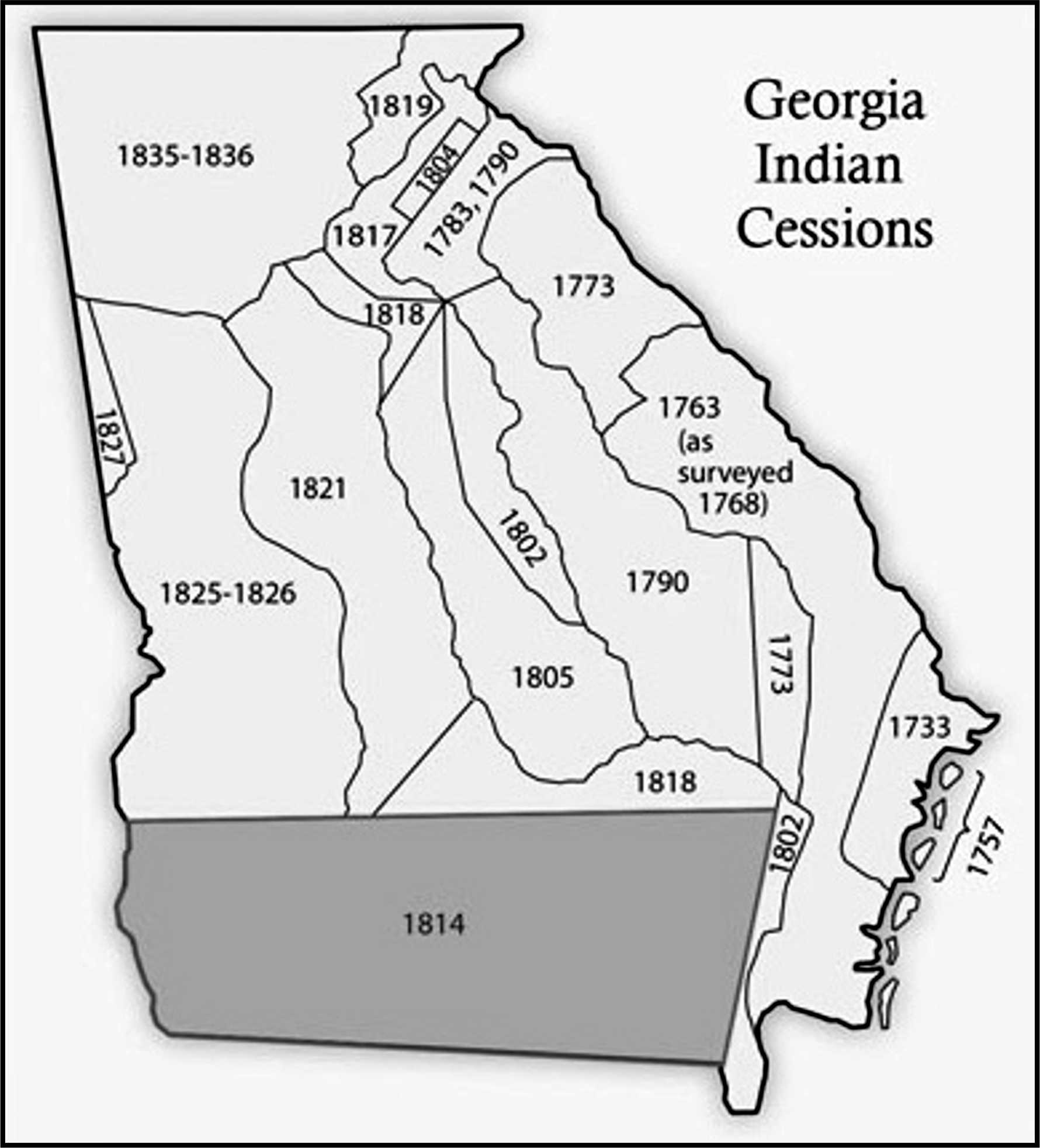
Following the American Revolution, American settlers gradually moved west into Creek (Muskogean) lands. The largest land cession followed the Creek Wars (1813/1814) when 22 million acres were lost to the USA.
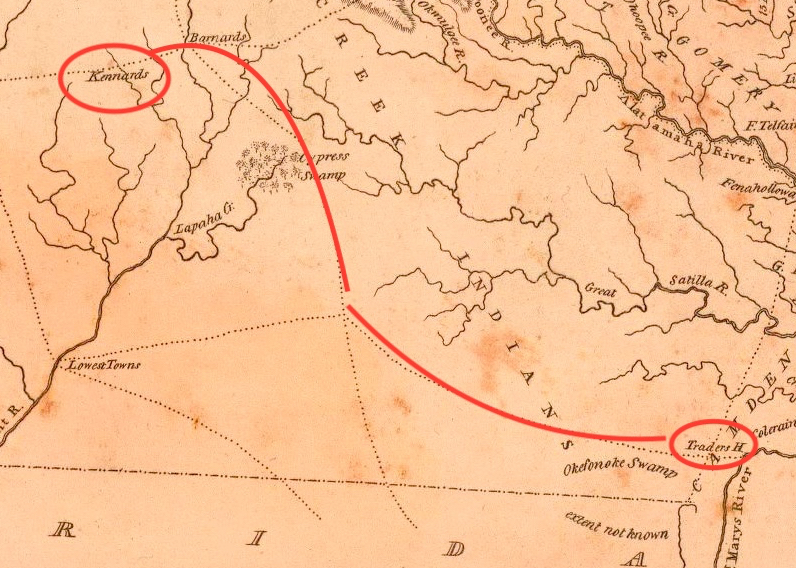
Kennard Trading Path from St. Marys River (Traders Hill) northwest to Kennard settlement near today’s Albany, GA.http://www.dav idrumsey.com
1815: At the Wakulla Spring two structures of Juan and Guillermo Kinnaird (Kennard) prompted historic and archaeological research.http://Pintado, Vicente Sebastián. Plano Borrador de las posesiones de los Señores Forbes y Compañia entre los Ríos Apalachicola y San Marcos en la Florida Occidental. Digital access to map: https://www.loc.gov/resource/g3932a.lh000880/ Choctaw and traders in similar setting (Louisiana) as the Creek living along the Wakulla River.commons.wikimedia.org/wiki/File:Choctaw_Village_by_Francois_Bernard.jpg


Book looks intriguing – every library should have one…
You have done some wonderful things for Wakulla Springs and the history of the region. Keep up the great work and let me know if I can help in any way!
—ROB
LikeLike